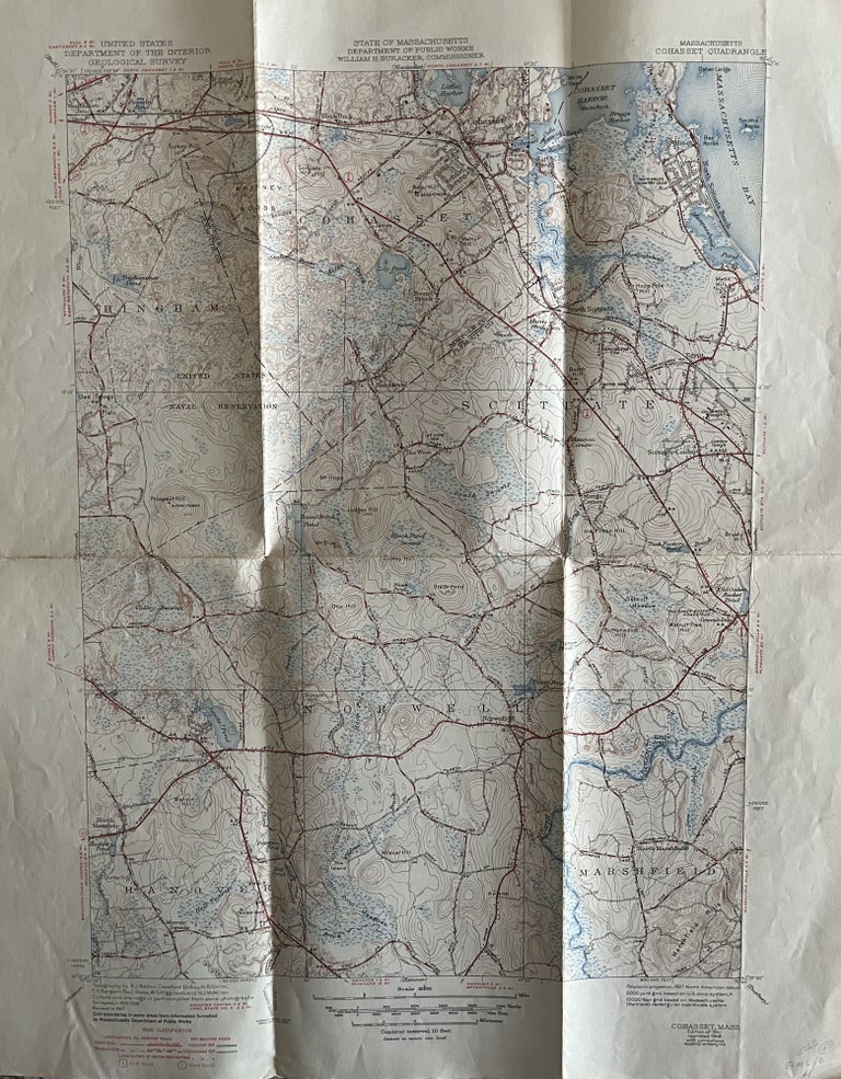
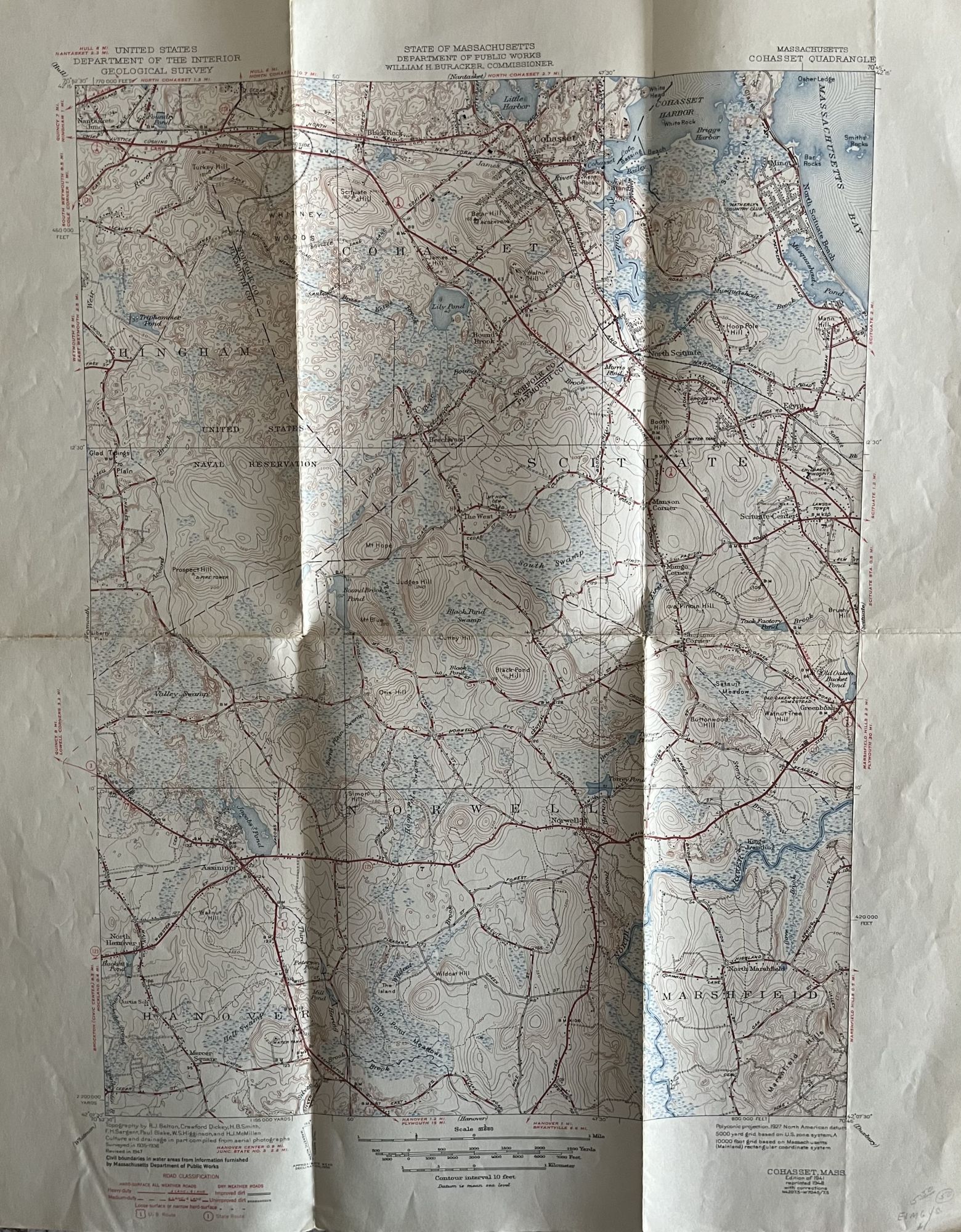
1947 State of Massachusetts Public Works Map of The Cohasset Quadrangle Including the Towns of Cohasset, Scituate and Norwell, Massachusetts
Washington: U.S. Department of the Interior/State of Massachusetts Department of Public Works, 1948. Softcover. Poster size 17"x 22" including border; Map size is 13" x 17." Four color map on recto. Verso contains a detailed explanation and Symbols of The Topographic Maps of the United States dated November, 1937. The United States Geological Survey publishes topographic maps of the entire United States. These maps are often used as the basis for other commercial map products and they serve as one of the best tools available for navigating the country's wild and urban terrain. The maps show contour lines [lines of equal elevation] which depict natural features of the land, as well as streams, roads, trails, forest types, buildings, and other natural man-made features. The 7 1/2 minute quadrangle maps are published at a scale of 1: 24,000. It has become more difficult over the years to find these older publication dates. Very Good with some light soiling and wear. Item #800038
Price: $50.00