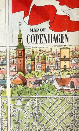
1947 Color Map of Copenhagen, Denmark
Copenhagen, 1947. Softcover. 4" x 6" eight [8] panel fold-out full-color illustrated map.
Copenhagen, 1947. Softcover. 4" x 6" eight [8] panel fold-out full-color illustrated map.
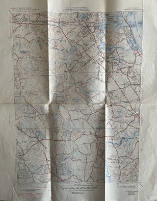
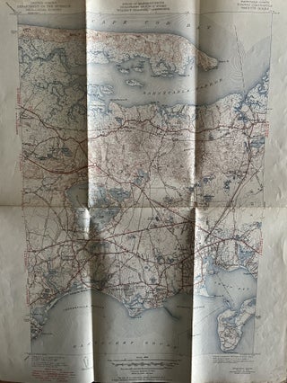
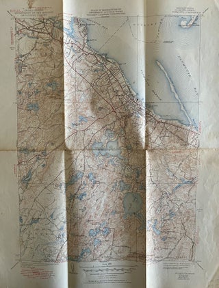
Washington: U.S. Department of the Interior/State of Massachusetts Department of Public Works, 1948. Softcover. Poster size 17"x 22" including border; Map size is 13" x 17." Four color map on recto. Verso contains a detailed explanation and Symbols of The Topographic Maps of the United States dated November, 1937. The.....
Washington: U.S. Department of the Interior/State of Massachusetts Department of Public Works, 1948. Softcover. Poster size 17" x 22" including border; Map size is 13" x 17." U.S. Department of the Interior Geological Survey. Four color map on recto. Verso contains a detailed explanation and Symbols of The Topographic Maps.....
Washington: U.S. Department of the Interior/State of Massachusetts Department of Public Works, 1948. Softcover. Poster size 17" x 22" including border; Map size is 13" x 17." U.S. Department of the Interior Geological Survey. Four color map on recto. Verso contains a detailed explanation and Symbols of The Topographic Maps.....
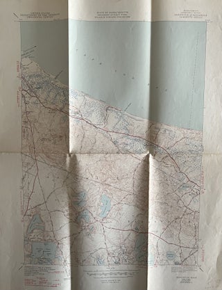
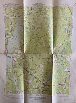
Washington: U.S. Department of the Interior/State of Massachusetts Department of Public Works, 1949. Softcover. Poster size 17" x 22" including border; Map size is 13" x 17." U.S. Department of the Interior Geological Survey. Four color map on recto. Verso blank. The United States Geological Survey publishes topographic maps of.....
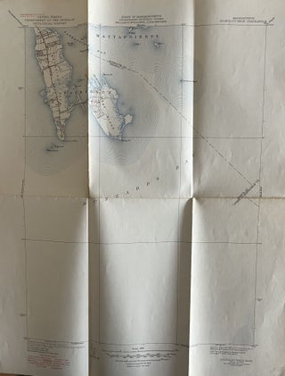
Washington: U.S. Department of the Interior/State of Massachusetts Department of Public Works, 1949. Softcover. Poster size 17" x 22" including border; Map size is 13" x 17." U.S. Department of the Interior Geological Survey. Four color map on recto. Verso contains a detailed explanation and Symbols of The Topographic Maps.....
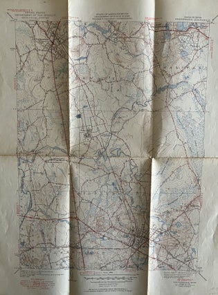
Washington: U.S. Department of the Interior/State of Massachusetts Department of Public Works, 1950. Softcover. Poster size 17" x 22" including border; Map size is 13" x 17." Four color map on recto. Verso blank. The United States Geological Survey publishes topographic maps of the entire United States. These maps are.....
Washington: U.S. Department of the Interior/State of Massachusetts Department of Public Works, 1950. Softcover. Poster size 17" x 22" including border; Map size is 13" x 17." U.S. Department of the Interior Geological Survey. Four color map on recto. Verso blank. The United States Geological Survey publishes topographic maps of.....

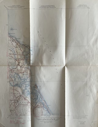
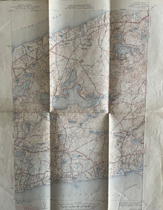
Washington: U.S. Department of the Interior/State of Massachusetts Department of Public Works, 1951. Softcover. Poster size 17" x 22" including border; Map size is 13" x 17." U.S. Department of the Interior Geological Survey. Four color map on recto. Verso blank. The United States Geological Survey publishes topographic maps of.....
Washington: U.S. Department of the Interior/State of Massachusetts Department of Public Works, 1951. Softcover. Poster size 17" x 22" including border; Map size is 13" x 17." U.S. Department of the Interior Geological Survey. Four color map on recto. Verso blank. The United States Geological Survey publishes topographic maps of.....
Washington: U.S. Army Corps of Engineers/State of Massachusetts Department of Public Works, 1951. Softcover. Poster size 17" x 22" including border; Map size is 13" x 17." U.S. Department of the Interior Geological Survey. Four color map on recto. Verso contains a detailed explanation and Symbols of The Topographic Maps.....
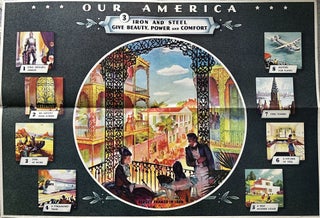
Atlanta? Coca Cola Company/Forbes Company, 1942. Softcover. Color offset lithograph. Dimensions of sheet: 32" x 22."Ê An educational poster for grade school instruction developed and distributed by the Coca-Cola Company about the beauty of iron and steel. Text on verso continues:" Chart for third week, artistic uses ... iron and.....
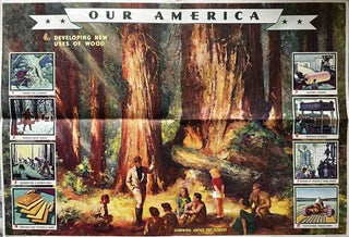
Atlanta? Coca Cola Company/Forbes Company, 1943. Softcover. Color offset lithograph. Dimensions of sheet: 32" x 22." Our America Classroom Instruction Poster. 1942-1949, an educational poster for grade school instruction developed and distributed by the Coca-Cola Company about different uses for wood and forest restoration and farming. Text on verso continues.....
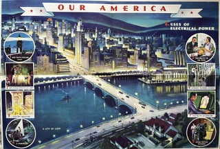
Atlanta: Coca Cola Company/Forbes Company, 1942. Softcover. Color offset lithograph. Dimensions of sheet: 32" x 22." Our America Classroom Instruction Poster, 1942. Educational poster for grade school instruction developed and distributed by the Coca-Cola Company. The series focused on American industry and was utilized as classroom aides during WWII. This.....
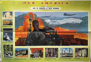
Atlanta? Coca Cola Company/Forbes Company, 1942. Softcover. Color offset lithograph. Dimensions of sheet: 32" x 22." An educational poster for grade school instruction developed and distributed by the Coca-Cola Company about the application of oil to the future and the future of oil.Ê Text on verso continues: "Chart for the.....
![Item #826202458 Pocket Directory and Indexed Map of New Canaan [CT]; Vol. 15, No. 3. A Monroe...](https://32-1rarebooks.cdn.bibliopolis.com/pictures/826202458.jpeg?width=320&height=427&fit=bounds&auto=webp&v=1724636534)
New Canaan: Monroe, 1965. Softcover.
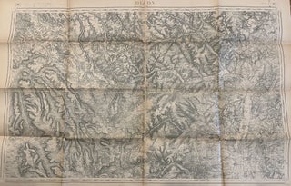
NP: Army of France, 1918. Softcover. Measures approximately 3 feet x 4 feet. In near fine condition with a few small splits. This is a 1913 edition of a map originally printed in France in 1844. This U.S. 1918 issue was printed by the 129th division of the U.S. Army.....
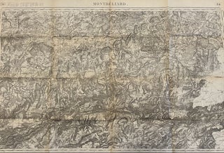
NP: Army of France, 1918. Softcover. Measures approximately 3 feet x 4 feet. In near fine condition with a few small splits. This is 1913 edition of a map originally printed in France in 1844. This U.S. 1918 issue was printed by the 129th division of the U.S. Army Corps.....

Hamilton: Bank of Bermuda Ltd., 1955. Softcover. 8vo.; single 11" x 4" sheet folded into 4 panels with black and white illustrations and color map.

London: BTA Publications, 1975. Softcover. Folding map includes streets, Underground routes and landmarks.

Chicago: University of Chicago Press, 1998. Hardcover. Small 4to., 181 pp. Index, Notes, Illustrations. Expresses perceptions of cities on plans.

Zurich: E. Wagner Kartographie, 1910. Softcover. 18" x 18" color map of lake Lucerne.

Toronto: Eaton's. Softcover.

Paris: Michelin, C1985. Softcover. Circa 1980s one-sided color map of Algeria and Tunisia.Ê 10" x 4 1/2" folding out to 48"x 10."
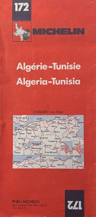
Paris: Michelin, C1985. Softcover. Circa 1980s one-sided color map of Algeria and Tunisia.Ê 10" x 4 1/2" folding out to 48"x 10."